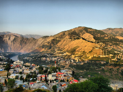

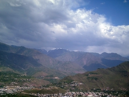
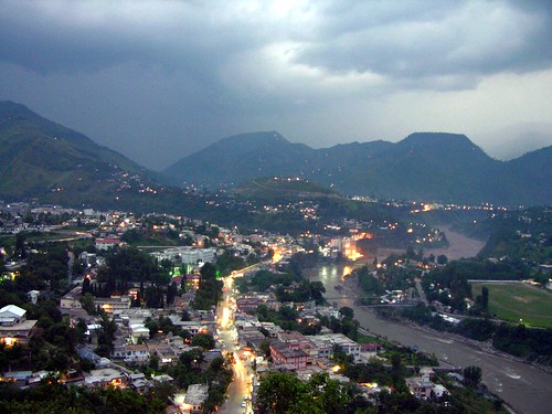
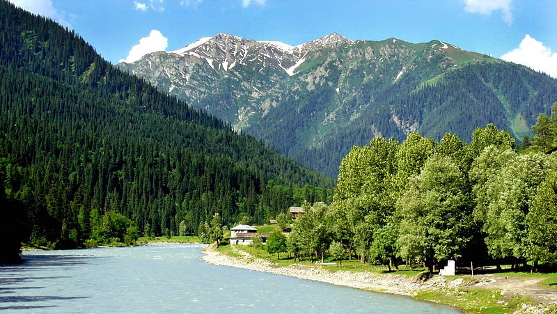
Muzaffarabad, the capital of Azad Kashmir, is situated on the confluence of the Jhelum and Neelum rivers. It is at a distance of 138 Km from Rawalpindi/Islamabad (Pakistan) and about 100 Km from Leepa. Muzaffarabad, once known as Chakrhi Bahk, derives its present name from Sultan Muzaffar Khan, a chief of the Bamba Dynasty established in 1662. Cradled by lofty mountains is a complex of old and new buildings of Muzaffarabad city, cotaining a blend of varied cultures and languages. There are two historical forts - the Red Fort and the Black fort situated at the opposite side of the Neelum river. The river streams proudly through the hubub of the town, joining river Jhelum at Domel and plays a dominant role in the micro-climate of Muzaffarabad. There are numerous religious Shrines of Sufi Saints in Muzaffarabad; Shrines of Sakhi Saheli Sarkar, Shah Anyat Wali and Dhani Mai Sahiba being the most notable.
Popular Attractions:
Muzaffarabad is a wonderful destination for trekking enthusiasts. There are a number of trekking trails that pass thorough some spectacular scenic spots in Muzaffarabad. Muzaffarabad has a number of beautiful monuments, farms and parks.
Pirchinassi -

the awe-inspiring locus, with an altitude of 3110m, it is located 32 Km east of Muzaffarabad. The facinating beauty of the place wins the admiration of nature lovers. The view of the summit at the neighbouring mountain peaks spell bounds of tourists. The devotees of Saint Pirchinassi come in large numbers to pay homage at the Shrine.
Neelum Valley -

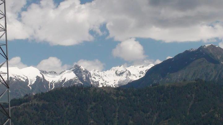
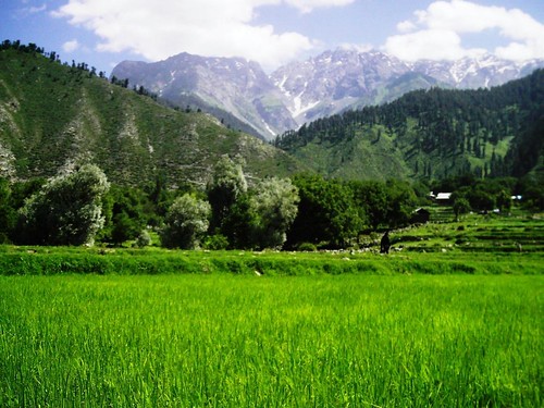
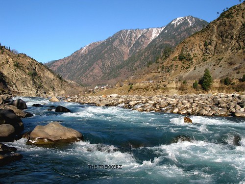
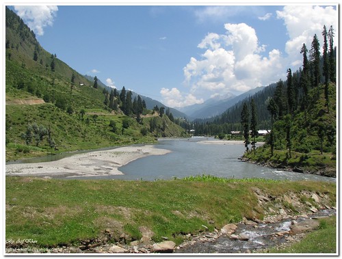
about 200 Km long the picturesque Neelum Valley is situated at the North & North-East of Muzaffarabad, running parallel to Kaghan Valley. The two valleys are only separated by snow-covered peaks, some over 4000m above sea-level. Excellent scenic beauty, panaromic views, towering hills on both sides of the noisy Neelum river, lush green forests, enchanting streams and attractive sorroundings make the valley a dream come true.
Athmuqam - is situated at a height of 1371m, it is the sub-divisional headquarters of the area. An attractive place known for its variety of fruit. All neceassary facilities viz bazaar, post office, banks, hospital, telephone exchange are present.
Neelum - at a distance of about 9 Km from Athmuqam, Neelum is situated on the right bank of the river Neelum at 1524m above sea-level with facinating scenery.The panaromic lush green valley is profound in fruit and wildlife.
Sharda - a breath-taking green spot at an altitude of 1981m. Shardi and Nardi are two mountain peaks overlooking the valley, reputedly named after legendary princess Sharda. It has a captivating landscape with numerous springs and hill-sides covered with trees. On the right bank, opposite Sharda, the Neelum is joined by the Surgan Nallah along which a track leads to Nurinar Pass and through it to the Kaghan Valley. Ruins of an old Buddhist University can also be found in Sharda.
Kel -
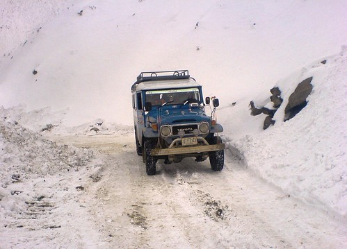
a small valley situated at a height of 2097m. This is an another picturesque place in the Neelum Valley. The Shounter Nallah joins river Neelum at this place and leads to Gilgit Agency (Northern Areas) over the Shandur Pass at 4420m.
Jhelum Valley


-
the curling Jehlum river passes through from East to West between the high green mountains joining river Neelum at Domel in Muzaffarabad. An artifical lake at Subri was created due to a cloud burst over the sorrounding hill during 1975. Further along the road, 24 Km from Muzaffarabad is located the small town of Ghari Dupata. A further 35Km, lies the famous town of Chakothi. This place sees a large concentration of troops because of the promixity of the Cease-Fire-Line and the constant agression by Indian forces. Other notable places of interst in the valley are Chikar, Loonbagla, Lungian and Danna, all known for their scenic beauty and healthy climate.
Leepa Valley -


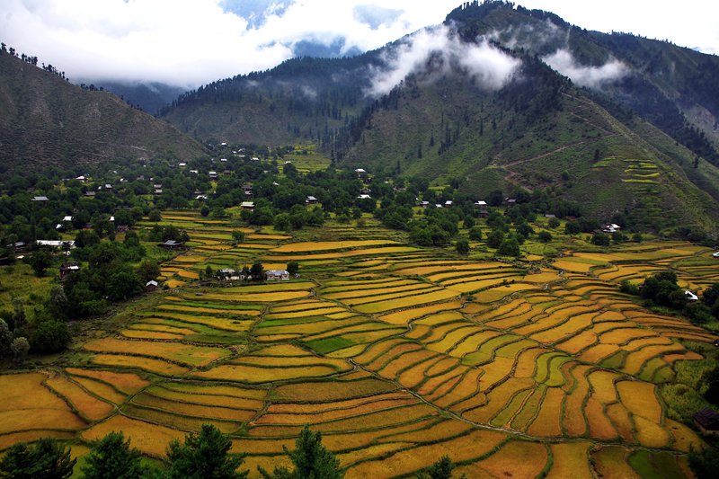
this is the most fascinating valley in Azad Kashmir. A fair-weather road branches off for Leepa from Naile 45 Km from Muzaffarabad, climbs over Reshian Gali at 3200m high and then descends into the Leepa Valley. It spell-bounds everyone who visists this valley. Dao Khan is well recognised for its natural beauty and renowned for its calm and peaceful atomsphere. Deep in the heart of the valley lies Leepa village at 1921m above sea-level. Its lush green river fields in summer and typical wooden Kashmiri houses present a wonderful view. Walnut, apples, cherries and honey of Leepa are very popular.
Muzaffarabad Fort:


generally known as Red Fort, traces back a checquered history. It is said that construction of the fort was initially taken up by the Chuk rulers to counter the offensives of the intruders. However, Sultan Muzaffarabad Khan, the founder of Muzaffarabad town, finally completed it in 1646. During the Mughal rule in Kashmir this Fort lost its importance, as they were more interested in other parts of their empire. But when Durrani's over-took the rule of this area, it again came in to limelight and its importance was recovered. Afterwards during the Dogra rule of Maharaja Ghulab Singh and Maharaja Ranbir Singh, the Fort was reconstructed and extended according to their political and militarial requirements. However, towards the end of 1947 the Dogra's fled away leaving the fort wide open to anybody. Since then it has braved devastating floods, ravages of time, and other hazards to project its inherent glory and historical background.
Shaheed Gali:


The comely beauty of the place attracts a restive mind to prolong his stay. The picturesque Shaheed Gali, situated at the height of about 1640 meters above sea level is at a distance of about 16 kilometers westward from Muzaffarabad. From Shaheed Gali a trek of 4 Kms leads towards a wholesome spot namely "Sri Kot". A tourist is bound to be fascinated by the serenity for the backdrop of the area. A Tourist Rest House is available for accommodation at Shaheed Gali.
Being the capital city is not only the hub of political and cultural activities but it also serves as a base camp for the tourists. It has various spots of leisure. View point Sathra, a public place, unravels the panorama of the entire city before a beholder. The junction point of the river Neelum and Jhelum presents a majic beauty from here. Lohar Gali, situated 9 kilometers from Muzaffarabad on Abbottabad road. The Red fort is a witness to the ancient history of this great city. The local market in Muzaffarabad can be explored for walnut carvings, kashmiri shawls and other traditional handicrafts. It is always possible to get a good bargain. It has besides official buildings; farms, parks and historic fort standing on the bank of the Neelum. Shopping is an exciting activity in Muzaffarabad and you can shop for Kashmiri shawls and walnut carvings.
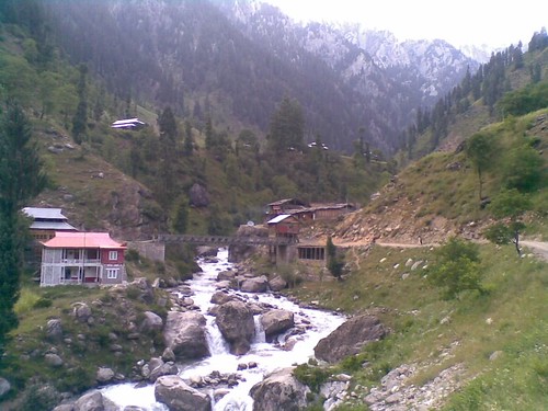
Ath’muqam
.jpg)
.jpg)
It is situated at a height of 1371m, it is the sub-divisional headquarters of the area and is an attractive place known for its variety of fruit. All necessary facilities like bazaar, post office, banks, hospital, and telephone exchange are present.
The awe-inspiring locus, with an altitude of 3110m, it is located 32 Km east of Muzaffarabad. The fascinating beauty of the place wins the admiration of nature lovers. The view of the summit at the neighboring mountain peaks spell bounds of tourists.
Halmat or Taobat.


The border village about 49 kilometers ahead of Kel is a fascinating but unexplored sight. The area from Kel to Taobat is called the Halmat. Janawai, Sardari and Halmat are the most beautiful places of this area. A tourist rest house has been constructed at Halmat to
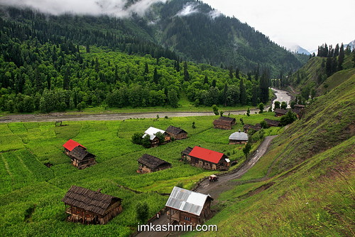
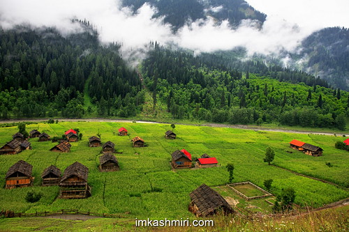
Dowarian.

.jpg)
.jpg)
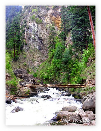
Dowarian is situated about 13 kilometers from Neelum at an altitude of 1615 meters. It is surrounded by mountains full of pine trees. About 30 km from here, a track goes deep inside Rattigali Pass, which connects Neelum and Kaghan Valley. A high alpine lake (4000m),
Kundal Shahi/Kutton.


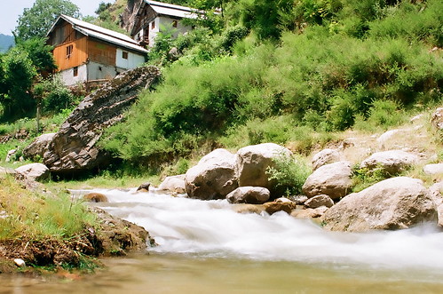

Kutton was our first rest stop, and is situated 10 km from Kundal Shahi. A road going west follows the Jagran River and climbs up to Kutton. There are some rest houses belonging to AJK Tourism department, and rest houses belonging to the hydro project management
No comments:
Post a Comment